
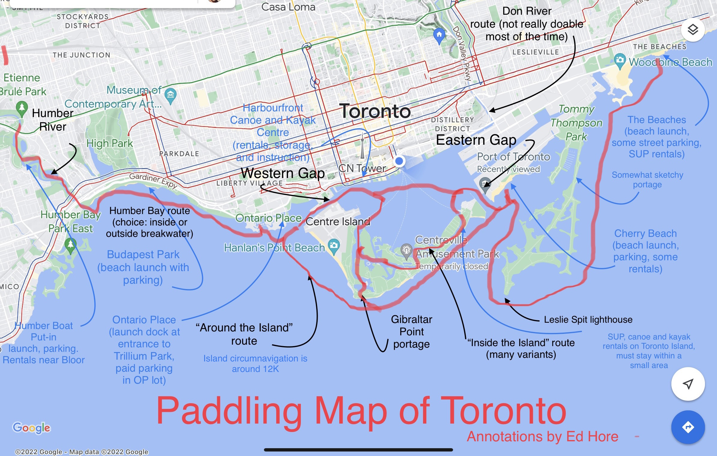
Chair Ed Hore has been kayaking around the amazing Toronto Waterfront for decades and gets a lot of questions about the best routes, where to launch, where to park, where to rent, and so on. So he recently tried his hand at an annotated Paddling Map of the waterfront that answers at least some of these questions.
Toronto is stunningly beautiful from the water. But always keep in mind it's on a Great Lake. Particularly in unsheltered areas, the Lake can get choppy and rough; weather changes can be unpredictable. Always make sure you paddle within your skill set. If in doubt take some lessons. There are introductory kayak, canoe and SUP lessons and rentals at Harbourfront Canoe and Kayak Centre and SUP lessons and rentals at various locations across the waterfront. Have fun!
Latest posts
Click here to RSVP.

Don’t miss Ken Greenberg’s opinion piece in the Toronto Star, July 8, 2026; if the Federal government delays quashing the BBTCA jets proposal, the resulting uncertainty will hurt the multi-billion Toronto Waterfront revitalization project because key investments won’t happen.